Travelling to HAT-Niederwenigern

by car

Click here to view the city map of Niederwenigern Click here to view the city map of Niederwenigern

[Back]

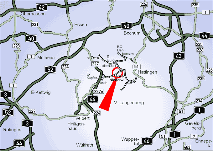
The following map is a segment of the Ruhr area. The red arrow points towards HAT-Niederwenigern. Further options are at your disposal below the map.

Click on Niederwenigern to view a city map

Description of arriving

Click here to get more information about this themeOnly in German From Essen
Click here to get more information about this themeOnly in German From Bochum
Click here to get more information about this themeOnly in German From Hattingen-Centre
Click here to get more information about this themeOnly in German From Düsseldorf

When you arrive, see the city map:

Click here to get more information about this themeOnly in German City map of Niederwenigern

Sie können auch mit öffentlichen Verkehrsmitteln nach Niederwenigern anreisen:

Click here to get more information about this themeOnly in German Anreise mit öffentlichen Verkehrsmitteln

When you have arrived in Hattingen, we recommend that you follow a historical path on the footsteps of Nikolaus and Elisabeth Groß:

Click here to get more information about this themeIn English Historical path through Niederwenigern

[Back]